

Thursday Ride Options
MAIN ROUTE: 43.9 miles, 3694 vertical ft, Thursday April 30th, Main Ride
SHORTER OPTION: 42.8 miles, 4182 vertical ft, Thursday April 30th, “Shorter” Ride
(Download RideWithGPS routes from links above)
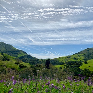
Today we will accomplish some still challenging miles and climbs while enjoying some of the terrain on the other side of 46 from where we were on Tuesday. There will be an invigorating ride out Old Creek Road along both options and then Santa Rita Road for those opting for the dirt in the Main route with a return through Templeton to Paso Robles. The shorter option will take you along Old Creek Road out to Whale Rock Reservoir for some views before turning around for your out and back route today. This option, while only shorter by a mile as written, can be as short or as long as you’d like given it is an out and back. It also remains on all paved roads, unlike the climb and then descent on dirt on Santa Rita in the main route.
The MAIN ROUTE first heads south through the town of Paso Robles to Highway 46 for the trip out to Old Creek Road. Watch carefully for oncoming traffic before making your left off of Highway 46 onto Old Creek Rd – it is at the intersection where you returned to Highway 46 on Tuesday’s ride. Old Creek will bring some gentle rollers followed by a descent before making your left turn onto Santa Rita Road after which the dirt road will soon greet you to begin about a 4.5 mile dirt ascent to the top for some gorgeous views out over the hillsides. Everyone who has cycled this route in past years has found this stretch of gravel road to be relatively smooth and not difficult to navigate. Winter rains may have produced some ruts in that road, so we will try and scout it out and report back on the conditions before we ride. We’re hoping that it will be somewhat freshly graded. After Santa Rita Road descends (about a 4 mile descent also on dirt) and comes into Templeton, the route returns to Paso Robles.
Our main ride currently includes a new option on our return home to Paso Robles which turns left onto Arbor Road after a brief stint on Highway 46 after Bethel Road. Arbor Road becomes hardpacked dirt before you return to pavement at your turn onto Kiler Canyon Road. We will be scoping this route upon arrival for camp this year so stay tuned in case we decide to adjust this route to remain on Highway 46 instead.
For the main ride, we will have two SAG stops, one along Old Creek Road before Santa Rita (we will announce details of more exact location in morning announcements after scoping the route), and at the at the top of the climb up Santa Rita Road. Please note for faster riders, Shawn may not yet be at the top when you arrive due to supporting both routes at the first SAG stop.
The “SHORTER” OPTION route will follow the same route as the main until it reaches the turnoff for Santa Rita Road. Instead it will continue on Old Creek to the views of Whale Rock Reservoir. Stop at one of the safe pullouts to take in the view. From there, it will turn around to head home the same way you came. This route can also be as short or as long as you would like. Please note there is a three mile descent and then a short climb along Old Creek to get to the observation areas. Please include the return climb in your calculations for your ride today. The full version of this “shorter” route actually has more climbing than the main route. Shawn will no longer be at the SAG stop by the time you go back by it a second time. This route option today can be made shorter, but as it is currently listed, it actually is only slightly shorter and has the potential for more climbing than the main!
Here is a RidewithGPS overlay option of today’s routes – check the box for “Show all on map” to see both routes together.
